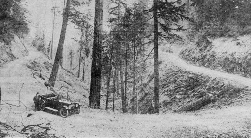
At the turn of the 20th century an influential group of civic leaders, park officials, and city planners worked to save the eastern slope of Tualatin Mountain (the area we now know as Forest Park) from development. So it’s ironic that the thing that probably had the biggest effect in preserving the area wasn’t that group’s valiant efforts, but rather the construction of a road that was intended to—of all things—promote development. We know that road as Leif Erikson Drive.
In the early 1900s Portland appeared to be on the verge of creating Forest Park—some four decades before the park was actually established. Civic leaders like Thomas Lamb Eliot and L. L. Hawkins wanted to protect the forested hillsides northwest of the city as a public park. The celebrated landscape architect John Charles Olmsted visited Portland in 1903 and wrote a parks master plan that included keeping those forested slopes in their natural state. In 1907, Portland voters approved a bond to fund Olmsted’s plan. If things had gone according to plan we might’ve celebrated Forest Park’s 110th anniversary this year.
But things didn’t go according to plan. First, the city decided to spend the bond proceeds on parks it already had, not to buy land for new parks (since most of the area of Forest Park was then privately owned). A few years later Portland faced an unemployment crisis, so city officials authorized logging on the slopes that Eliot and others sought to protect. And then the developers came.
.jpg?Action=thumbnail&algorithm=fill_proportional&width=465)
In 1914, as now, real estate was all about location. Developers had already transformed steep hillsides into desirable neighborhoods like Kings Heights and Willamette Heights. The hillsides northwest of Willamette Heights clearly beckoned, since they offered several thousand acres of undeveloped land with the potential for panoramic views. Developers began platting new subdivisions on maps of the area, and investors quickly bought up lots.
It’s hard to develop property if you can’t get to it, so a developer named Richard Shepard built a road to open up access to the proposed subdivisions.
The road was named Hillside Drive, and true to its name, it was built along the hillside from Thurman Street to Germantown Road—a distance of over 11 miles. It was the first of what were supposed to be dozens of streets in the new subdivisions. It would also be the last.
The development of Hillside Drive and the surrounding area was undermined by two influential factors: money and geology. For one thing, the cost of building the road turned out to be almost twice what Shepard and his colleagues had originally estimated—in today’s dollars, the cost ran to almost $3,600,000. And that was before the landslides.
As Portland-based geologists and planners can tell you, Portland’s West Hills are covered with a thick silt layer that becomes unstable when wet. This results in landslides every winter, especially on steep slopes like those that Hillside Drive was cut into. Hillside Drive was hit with landslides in its very first winter, which added another $72,000 (in today’s dollars) to the total cost of the project.
The city initially paid about 10% of the road construction bill. It then tried to raise the rest through a special assessment against properties along Hillside Drive and in the platted (but still unbuilt) subdivisions. Most of the property owners couldn’t or wouldn’t pay the assessment, and like a large-scale game of Monopoly the city seized lots all across what is now Forest Park (amounting to some 1,400 acres in all). While some owners paid the assessment and got to keep their property, the experience discouraged most of them from ever developing the land.
The hillsides had been saved from development, but a temperamental road remained. Passenger cars would occasionally attempt to drive it in the 1920s, though success usually depended on bringing their own road clearing equipment. In the 1930s the city tried to improve Hillside Drive as a public works project, but frequent landslides continued to discourage regular traffic. It was then that the Sons of Norway convinced the city to rename the road after the Viking explorer Leif Erikson.
Forest Park was established in 1948, and Leif Erikson Drive has been at its center since the very beginning. Its relatively gentle grade and lack of motorized traffic make it both a destination in its own right and an access route for various side trails and loop options. What was seen as a colossal failure a century ago helped make Forest Park the vast urban forest we know and cherish today.
Chris Knutson is an archaeologist and regular FPC volunteer.


